Utility Locating in Palm Beach County
Palm Beach County is one of the fastest-growing construction markets in the United States. From the luxury coastal development of Boca Raton and Delray Beach to the booming inland communities of Wellington and Royal Palm Beach, construction activity across Palm Beach County demands reliable, fast-mobilizing utility locating and excavation services that keep projects on schedule and crews safe.
US Utility Potholing serves all of Palm Beach County from our Pompano Beach base. Our crews provide private utility locating, GPR scanning, vacuum excavation, utility potholing and daylighting, and SUE utility mapping to the engineers, contractors, and municipal clients who build and maintain Palm Beach County's infrastructure.
Palm Beach County is where we do most of our GPR work. The mix of older coastal infrastructure in Palm Beach and Delray and new construction out west means a lot of what is underground was never accurately recorded, and ground penetrating radar is often the only thing that finds it.
Palm Beach County Cities We Serve
West Palm Beach
Utility locating, potholing & GPR for Palm Beach County's urban core and downtown corridor.
Boca Raton
Private utility locating and SUE mapping for Boca Raton's active commercial development market.
Delray Beach
Vacuum excavation and utility potholing for Delray Beach construction and infrastructure projects.
Boynton Beach
GPR scanning and utility locating for Boynton Beach's growing development corridor.
Lake Worth Beach
Soft dig vacuum excavation and private utility locating in Lake Worth Beach.
Palm Beach Gardens
Utility mapping and potholing for Palm Beach Gardens' commercial and mixed-use projects.
Jupiter
Private utility locating and GPR for Jupiter area construction and development.
Wellington
Utility locating and vacuum excavation for Wellington's residential and commercial projects.
We also serve: Royal Palm Beach, Greenacres, Lantana, Lake Clarke Shores, Palm Springs, Riviera Beach, North Palm Beach, Tequesta, Juno Beach, Palm Beach Shores, Pahokee, Belle Glade, South Bay, Haverhill, Loxahatchee, and all other Palm Beach County communities.
GPR West Palm Beach — Ground Penetrating Radar Specialists
West Palm Beach is the commercial and government hub of Palm Beach County, with a dense utility infrastructure built up across its major arterials and downtown core over many decades. The Okeechobee Boulevard corridor, Palm Beach Lakes Boulevard, Southern Boulevard, Congress Avenue, and Dixie Highway carry layered utility installations — public and private, documented and undocumented — that create significant underground complexity for contractors and engineers working in the area.
For West Palm Beach projects, GPR scanning is particularly important because a large portion of the area's water distribution and irrigation infrastructure is non-conductive HDPE and PVC — invisible to electromagnetic locating. Our GPR scanning service covers all common utility detection applications in the West Palm Beach market, including pre-HDD bore path clearance, concrete scanning before core drilling or saw-cutting, and comprehensive subsurface investigation for sites with incomplete utility records.
We bring the same professional GPR equipment and trained technician team that serves our Broward County home market to every Palm Beach County project. West Palm Beach and Boca Raton are regular service areas for our crews, with same-day and next-day service available in most circumstances. For projects in northern Palm Beach County — Palm Beach Gardens, Jupiter, and the Treasure Coast communities — we provide scheduled service with advance notice. Learn more about our GPR scanning capabilities.
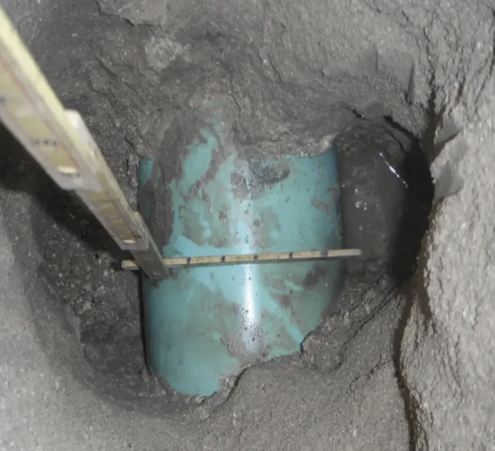
Palm Beach County Utility Potholing — Key Projects
- Palm Beach County Water Utilities Department pipeline and infrastructure projects
- FDOT District 4 road widening, interchange, and corridor projects requiring ASCE 38-22 SUE
- Electric utility underground distribution expansions in West Palm Beach, Boca Raton, and Delray Beach
- Boca Raton and Delray Beach commercial site development utility clearance
- Wellington and Royal Palm Beach residential subdivision utility locating
- Palm Beach International Airport area utility locating and mapping
- Brightline and transit corridor utility clearance in Palm Beach County
Cities We Serve in This County
- Utility Locating in West Palm Beach, FL
- Utility Locating in Delray Beach, FL
- Utility Locating in Boynton Beach, FL
Related services: SUE services for Palm Beach County design teams · GPR utility locating in Palm Beach County · West Palm Beach potholing
The Design-Phase SUE Workflow, Start to Finish
We deliver the two ASCE 38-22 quality levels that come from the field: QL-B designating and QL-A test holes. QL-B establishes horizontal position using electromagnetic locating and ground penetrating radar across the full work limits. QL-A exposes the utility by vacuum excavation and measures top-of-pipe elevation, outside diameter and material. Owner records and surface features are useful for planning a corridor — the county water and wastewater utility, the municipal systems, FPL, gas and the telecom carriers all hold pieces of the picture — but a records drawing is not a measurement, and we do not issue one as a deliverable.
QL-B is the designating step. Crews sweep the site with electromagnetic induction equipment and ground penetrating radar together, trace what is traceable, interpret what is not, and record horizontal alignments on sub-inch accurate GPS. QL-A is the test hole: vacuum excavation exposes the facility and we measure top-of-pipe elevation, outside diameter, and material at a specific station. Most projects need QL-B across the whole work area and QL-A at a limited, deliberately chosen set of points. Deciding which points those are is a design conversation, and it is worth having before the crew mobilizes.
Conflict Matrices and Where the Test Holes Go
Once designating is complete, the useful product for a design team is a conflict matrix: each existing utility crossing or paralleling the proposed improvement, listed with its designated horizontal position, what is known and not known about its depth, and whether the proposed work clears it, conflicts with it, or cannot be determined without a measured elevation. That third category is the one that drives the test hole program, and it is usually a much shorter list than a blanket allowance would suggest.
From there, test holes are placed where elevation controls the design: proposed storm and sanitary crossings of existing pressure mains, drilled shaft and pile locations, retaining wall and box culvert footprints, and any point where the designating marks show two facilities sharing what appears to be the same trench. Each hole returns a measured elevation that either clears the conflict or defines the relocation. Along constrained corridors such as I-95, the Florida Turnpike, Okeechobee Boulevard, and US-1, that distinction decides whether a design proceeds or a utility agreement has to be negotiated. Each hole is located on sub-inch accurate GPS and tied back to the designated alignment, so the matrix closes out with measured values rather than notes about what still needs verifying.

What Designating Can and Cannot Tell You
Designating establishes horizontal position. It does not establish depth, and we do not present it as though it does. A depth estimated from electromagnetic signal geometry depends on assumptions about the conductor and the surrounding soil, and ground penetrating radar depth readings drift with the South Florida water table because the calculation depends on signal velocity through the soil, which moves with moisture content. Palm Beach County sites near the coast, alongside canals, and in the western communities around Wellington all see that variation. Where a designer needs an elevation they can put in a design file and defend in a review, the answer is a test hole. That is the one method that returns a measured number.
Permitting Submittals and Design Review
SUE deliverables get read by people who were not on site, so they have to stand on their own. We issue the utility picture as a KMZ Google Earth overlay for field and stakeholder review, a CAD file that references directly into the design model with layers separated by owner and type, and a PDF for the submittal package. Every line carries its quality level, and every test hole carries its measured elevation, material, and diameter. A reviewer at a municipality or a utility owner can see precisely what was verified and by what method.
That documentation also supports utility coordination correspondence and relocation agreements. When a design in Boca Raton, Delray Beach, Boynton Beach, Jupiter, or Palm Beach Gardens requires an owner to move a facility, the request carries more weight with a measured elevation and a GPS-located test hole attached than with a note referencing a record drawing. The same package supports the contractor at bid time, which tends to reduce the utility contingency being priced into the job.
Palm Beach County Utility Locating — Frequently Asked Questions
Do you offer same-day utility locating in Palm Beach County?
We offer same-day and next-day utility locating service throughout Palm Beach County based on technician availability. For urgent requests in West Palm Beach, Boca Raton, Delray Beach, and Boynton Beach, call us directly at (954) 849-2859 — we will make every effort to accommodate your schedule. For northern Palm Beach County (Palm Beach Gardens, Jupiter, and beyond), next-day or scheduled service is typical. We respond to all quote requests within 2 hours during business hours.
Why is GPR scanning especially important in West Palm Beach?
West Palm Beach has a high proportion of non-conductive utility infrastructure — HDPE water mains, PVC drainage and sewer, and concrete box culverts that electromagnetic locating equipment cannot detect. Additionally, the area's rapid growth means many sites have undocumented private utilities from multiple construction eras. GPR scanning detects non-conductive utilities and helps identify features with no record documentation, making it an essential complement to EM locating for comprehensive utility clearance in this market.
Can you handle FDOT projects in Palm Beach County?
Yes. We provide SUE data collection — QL-B utility designating (EM and GPR) and QL-A potholing — for FDOT District 4 projects throughout Palm Beach County. FDOT's increasing use of SUE requirements on D4 projects reflects the utility density and complexity of South Florida's transportation corridors. We are familiar with FDOT's utility accommodation policy and the deliverable formats required for FDOT SUE contracts. Contact us to discuss your FDOT project needs in Palm Beach County.
Cities We Serve in This County