Broward County Utility Locating — Local Experts
Broward County is one of Florida's most active construction markets and one of the most utility-dense counties in the southeastern United States. With over 1.9 million residents and billions in annual construction activity, Broward County's underground utility network spans hundreds of miles of water mains, force mains, electrical duct banks, telecom conduit, gas lines, and stormwater infrastructure — much of it aging, mis-mapped, or undocumented.
As a Pompano Beach-based company, Broward County is our home market. We work in Fort Lauderdale, Deerfield Beach, Hollywood, Coral Springs, Pembroke Pines, and every other Broward municipality on a daily basis. We know the local utility owners, the permit requirements, the soil conditions, and the construction environment. That local knowledge reduces your risk and speeds your project.
Our services in Broward County include private utility locating, GPR scanning, vacuum excavation soft dig, utility potholing and daylighting, and SUE utility mapping per ASCE 38-22.
Broward County Cities We Serve
Fort Lauderdale
Utility locating, potholing & GPR for Broward County's urban core and downtown corridor.

Pompano Beach
Our home base — immediate mobilization for all utility services in Pompano Beach.
Hollywood
Soft dig, vacuum excavation & utility locating for Hollywood's active development market.
Deerfield Beach
Private utility locating and potholing for Deerfield Beach construction and infrastructure projects.
Coral Springs
GPR scanning and utility mapping for Coral Springs commercial and municipal projects.
Pembroke Pines
Vacuum excavation and SUE mapping for Pembroke Pines development and utility work.
Miramar
Utility potholing and daylighting for Miramar's infrastructure and commercial construction.
Davie
Private locating and soft dig excavation for Davie's mixed commercial and residential projects.
We also serve: Plantation, Lauderhill, Tamarac, Oakland Park, Wilton Manors, Dania Beach, Hallandale Beach, Cooper City, Weston, Margate, Coconut Creek, North Lauderdale, Lauderdale Lakes, Lighthouse Point, and all other Broward County municipalities.
Underground Utility Locating in Broward County — What Contractors Need to Know
In Broward County, calling 811 before excavating is required by Florida law — but 811 only notifies public utilities. The majority of utility strikes on Broward County construction sites involve private utilities that 811 never marked. Our private utility locating service covers everything 811 misses, including irrigation systems, site electrical, private telecom, and fire suppression lines on commercial and municipal properties across Broward.
For projects in the Broward County right-of-way — on Federal Highway, SR 7, Broward Boulevard, Griffin Road, or any county or state arterial — our teams coordinate directly with FDOT, Broward County Traffic Engineering, and the relevant municipal public works departments for permitting and MOT compliance.
Broward County Utility Projects — Common Applications
- Pre-construction utility clearance for commercial developments along I-95, US-1, and Broward Boulevard corridors
- Broward County Water and Wastewater Services pipeline projects requiring QL-B and QL-A SUE data
- Electric utility underground distribution upgrades in Fort Lauderdale, Hollywood, and Pembroke Pines
- Port Everglades and FLL Airport area utility locating for infrastructure improvements
- Road widening and Complete Streets projects throughout Broward's municipal network
- Tri-Rail corridor utility clearance for transit infrastructure projects
Cities We Serve in This County
Related services: subsurface utility engineering in Broward County · private and underground utility locating in Broward County · potholing in Fort Lauderdale
GPR Scanning in Broward County
Broward County's underground utility infrastructure includes a significant percentage of non-conductive systems — HDPE water mains, PVC sewer lines, concrete storm drainage, and private fiber optic conduit — that standard EM locating cannot detect. Our GPR scanning service complements EM locating to provide the most complete underground picture available, identifying non-metallic utilities and subsurface anomalies that would otherwise remain invisible until a backhoe or boring machine encounters them.
Working With a Broward County Crew
Local presence matters in utility locating. Working with a Broward County-based crew means lower mobilization cost and a team that knows the county's utility owners, permitting requirements, and underground infrastructure.
We respond to all quote requests within 2 hours and can typically schedule Broward County utility locating and potholing jobs within 1–2 business days. For urgent or emergency situations, call (954) 849-2859 and we will do our best to mobilize the same day.
Why QL-B Designating Comes First in Broward County
Designating, Quality Level B under ASCE 38-22, is the geophysical interpretation of where subsurface utilities exist horizontally. It is not a records exercise and it is not a line scaled off an as-built. Crews sweep the site with electromagnetic induction equipment, energize accessible conductive facilities where connection points allow, trace them through the work area, and mark the interpreted alignment on the ground. Ground penetrating radar runs alongside the EM sweep on every project to look for what EM cannot see: non-metallic water and sewer services without tracer wire, PVC conduit, abandoned lines, and vaults or structures that do not appear on any drawing.
What designating gives you is horizontal position. It does not give you depth. Any depth figure produced by a locator is an estimate derived from signal geometry, and in Broward the ground penetrating radar picture drifts as the South Florida water table moves, because the depth calculation depends on how fast the signal travels through the soil. We report designating results as horizontal alignments and we state that plainly in the deliverable. If your design needs a verified elevation on a specific utility at a specific station, that comes from a test hole, and we mobilize vacuum excavation to get it. On a Broward site that distinction is not academic, because a shallow and moving water table means the same facility can read differently on two visits weeks apart.
Dense Corridors and Congested Rights-of-Way
Broward's east-west and north-south corridors are where designating earns its cost. The I-95 spine, the I-595 corridor, I-75 and the Sawgrass Expressway on the west side, the Florida Turnpike, and US-1 through the eastern cities all carry bundled utilities in constrained rights-of-way, frequently under pavement that has been cut, patched, and resurfaced many times over. Interchange areas and frontage roads compound the problem, because utilities were relocated to accommodate each successive roadway project and the relocations were not always recorded to a consistent datum.
Downtown Fort Lauderdale and the older sections of Hollywood and Pompano Beach add a second layer: conductive clutter. Rebar, wire mesh, metal drainage structures, rail, and dense duct banks all return signal, and a single-method sweep in that environment produces marks that look confident and are not. Running EM and GPR together lets us reconcile conflicting responses instead of reporting the first one we find, and where the two methods disagree we show where they disagree rather than averaging them into a single line on a plan. Sites close to the ocean and along the Intracoastal add salt-influenced soil conditions that further limit how far radar energy penetrates before the return becomes unreadable, which is another reason we do not lean on radar alone.
From Designating to QL-A Test Holes
Once the horizontal picture is established, the utilities that actually control the design get test holes. We vacuum excavate with a vac truck, or with air and barrel soft dig where access is tight or the surface has to stay intact, expose the facility without damaging coating or conduit, and record top-of-pipe elevation, outside diameter, material, and horizontal position on sub-inch accurate GPS. That is Quality Level A: a measured point, not an interpretation. On a Broward roadway or drainage project the test holes usually go where a proposed storm line crosses an existing pressure main, where a drilled shaft or pile is planned, and wherever the designating marks show two facilities occupying what looks like the same trench.
Designating Across Broward Municipalities
Work in Broward rarely stays inside one jurisdiction. A single corridor project can cross municipal water and wastewater systems in cities that operate their own utilities, county-maintained facilities, FPL distribution and transmission, and multiple telecom carriers, each with its own records and its own idea of where its facilities sit. Designating gives every party a common horizontal picture on one plan, in one coordinate system, which is the practical value of SUE on a multi-owner corridor.
We deliver that picture in formats your team can use immediately: a KMZ overlay for field verification and stakeholder review in Google Earth, CAD for the design file, and PDF for permitting and submittal packages. Deliverables are labeled by ASCE 38-22 quality level so reviewers can see which lines were designated geophysically, which were verified by test hole, and which came from records alone. Projects in Sunrise, Plantation, Davie, Pembroke Pines, and Deerfield Beach get the same workflow as work in the coastal cities. Where a municipality or a utility owner wants the marks left in the field as well as recorded digitally, we paint and flag to the standard color code before demobilizing.
Frequently Asked Questions
Do I need private utility locating if I've already called 811?
Yes, in almost every commercial construction situation. Calling 811 is required by Florida law, but 811 only covers publicly registered utilities. On most Broward County commercial construction sites, the majority of underground strike risk involves private utilities — site electrical, irrigation, private telecom, and other owner-installed systems — that 811 will never mark. Private utility locating fills this gap and provides the complete underground picture you need to excavate safely.
How long does utility locating take in Broward County?
A typical commercial site in Broward County — say, a retail strip center pad or a medium-sized commercial site — can be locating-swept in 2–4 hours. Larger sites, more complex utility environments, or scopes that include GPR scanning take proportionally longer. We provide project-specific time and cost estimates — contact us with your project address and scope and we will give you a specific quote.
What documentation do you provide after utility locating?
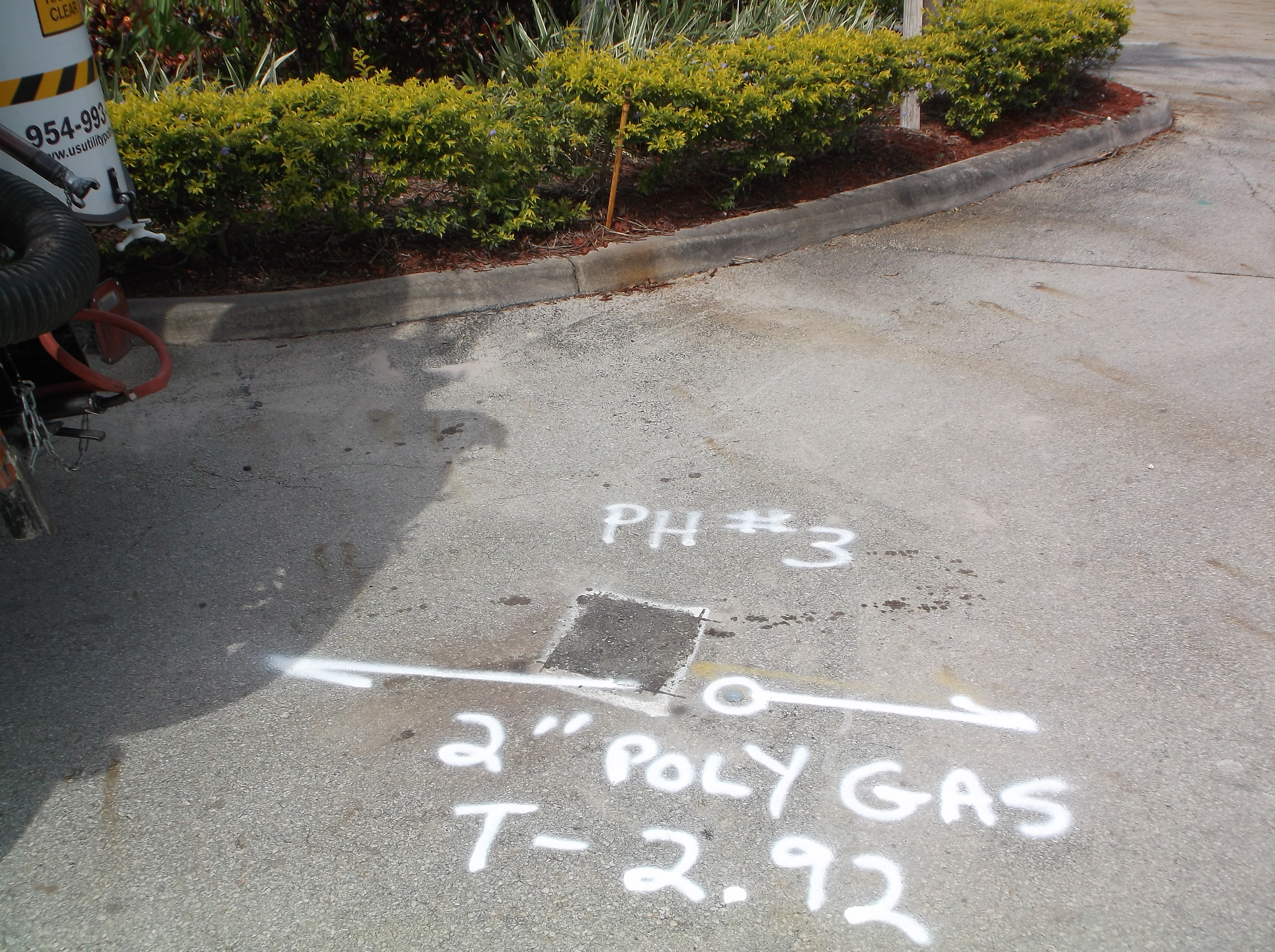
Every job includes pink field markings with letter designations identifying each utility. We provide a written field report documenting the work performed, utilities located, and any areas of uncertainty. For SUE projects, we provide Quality Level B and A reports per ASCE 38-22. We can also provide a scaled sketch or GIS-referenced deliverable for your project records on request.
Cities We Serve in This County
Fort Lauderdale · Hollywood · Pompano Beach · Coral Springs · Pembroke Pines · Miramar · Plantation · Davie · Deerfield Beach · Sunrise