What Is Utility Mapping and SUE?
Underground utility mapping — also called Subsurface Utility Engineering (SUE) — is the systematic process of identifying, locating, and documenting underground utilities to produce an accurate, georeferenced map of all subsurface infrastructure within a project corridor. SUE maps are essential deliverables for civil engineering design, construction risk management, right-of-way permitting, and infrastructure asset management.
The industry standard governing SUE practice in the United States is ASCE 38-02: Standard Guideline for the Collection and Depiction of Existing Subsurface Utility Data. This standard defines four Quality Levels (QL-D through QL-A) that describe the accuracy and confidence level of utility data, and establishes the methods required to achieve each level.
US Utility Potholing provides complete SUE utility mapping services across South Florida — from initial desktop research and private utility locating through GPR scanning, vacuum excavation test holes, GPS surveying, and final CAD deliverable production. Our maps give your engineering team the accurate subsurface data needed to design around existing utilities, avoid costly conflicts, and satisfy project owner and permit requirements.
ASCE 38-02 Quality Levels — What We Deliver
- Quality Level D (QL-D) — Records Research: Utility data compiled from existing records, as-built drawings, permit files, and utility owner contacts. Lowest confidence — establishes the baseline before field work begins.
- Quality Level C (QL-C) — Surface Feature Survey: Visible above-ground utility features (valve boxes, manholes, markers, pedestals) are surveyed and correlated to utility records to refine horizontal positioning.
- Quality Level B (QL-B) — Surface Geophysics: Electromagnetic (EM) utility locating and GPR scanning determine two-dimensional (horizontal) position of underground utilities. This is the standard required for most design-phase utility coordination in South Florida.
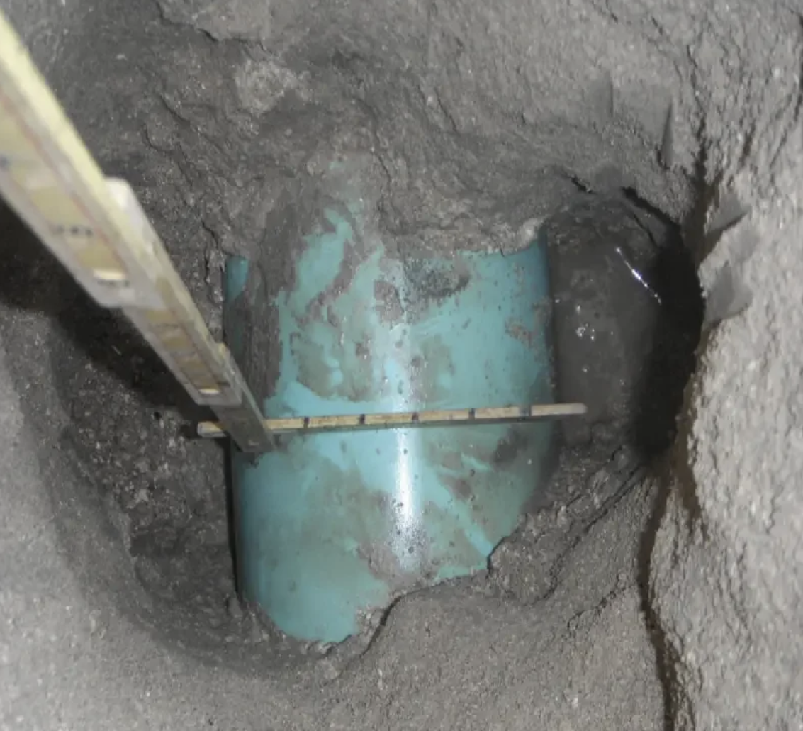
- Quality Level A (QL-A) — Vacuum Excavation (Potholing): Physical test holes expose utilities and record exact three-dimensional position (depth, horizontal offset, diameter, material). Required at critical crossings and design conflict points. The highest accuracy level under ASCE 38-02.
Who Needs Underground Utility Mapping in South Florida?
Our SUE mapping services support a broad range of clients across the South Florida construction and engineering community:
- Civil engineers and design firms: Utility mapping at QL-B and QL-A provides the data needed to design new infrastructure around existing utilities, reducing RFIs, change orders, and construction-phase surprises.
- Municipalities and county agencies: Broward County, Miami-Dade, and Palm Beach County municipalities commission utility mapping for road widening, drainage improvements, water/sewer rehab, and capital infrastructure programs.
- General contractors: Pre-construction utility mapping documents existing conditions and establishes a clear liability baseline before ground-breaking.
- Electric utilities: Power companies require mapped utility clearances when planning new underground distribution infrastructure in congested South Florida corridors.
- Transportation and FDOT projects: State and county road projects require SUE per ASCE 38-02 as a standard deliverable during PD&E and design phases.
- Real estate developers and site planners: Due-diligence utility mapping for development sites in Broward, Miami-Dade, and Palm Beach counties to identify utility constraints before committing to a design.
Our Utility Mapping Deliverables
Every utility mapping project delivers a complete, usable dataset tailored to your project's needs:
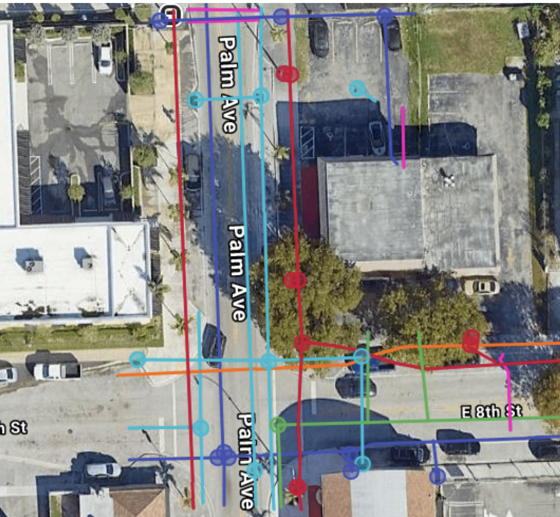
- AutoCAD (.dwg) and/or GIS-compatible utility mapping files with all located utilities plotted to survey control
- APWA color-coded utility linework (red=electric, yellow=gas, blue=water, orange=telecom, green=sewer, purple=reclaimed, pink=survey, white=proposed)
- QL-A test hole data tables with GPS coordinates, depths, diameters, and material for each pothole location
- Field data sheets and photographic documentation for each test hole
- SUE report narrative documenting methodology, equipment, quality level designations, and limitations
- PDF plan sheets formatted to project drawing standards
Utility Mapping and GPR Pipe Locating
One of the most significant gaps in traditional utility mapping is the omission of non-conductive utilities — PVC water mains, HDPE gas lines, and concrete storm structures installed without tracer wire. These lines are invisible to standard EM locating and are frequently missing from as-built records in South Florida's older developed areas.
Our integration of Ground Penetrating Radar (GPR) scanning into the QL-B phase ensures that non-conductive utilities are detected and mapped. GPR utility mapping — combining ground penetrating radar with GPS-referenced field marking — is the only way to achieve complete underground pipe mapping in corridors where older PVC and HDPE installations lack tracer wire. As a dedicated GPR pipe locator and utility scanning contractor, we detect the utilities that EM alone misses, producing maps your engineering team can trust. This is especially critical in Miami-Dade and Broward County's mature urban corridors where decades of uncoordinated utility installations have created complex, undocumented subsurface environments.